The root-zone soil moisture refers to the amount of water present in the layer where plants can freely absorb it. In the case of the SMOS product, it is calculated directly from satellite observations of the surface soil moisture, using a simple subsurface model (3 distinct layers, each characterized by a different time constant τ, which represents the time required to pass water from one layer to another)
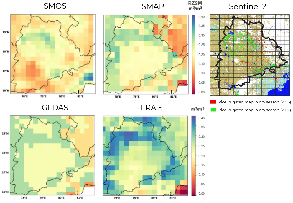
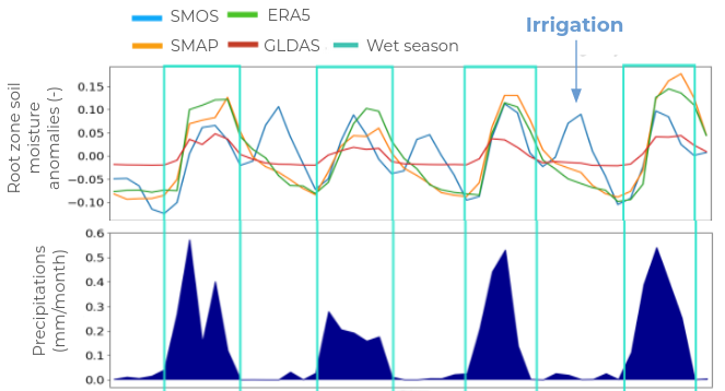
Various methods exist to estimate the soil moisture in the root zone, including ground measurements (e.g., from the International Soil Moisture Network) and data assimilation methods (e.g. GLDAS, ERA5, SMAP) which combine satellite observations with numerical models. In a recent paper, N. Ojha compared these different products and found that data driven by direct satellite observations (which is the case of SMOS) are particularly effective in identifying irrigated areas, while other methods (models and assimilation driven methods) fail to do so.
The example of Telangana, a region in India heavily irrigated during the dry season (as illustrated with Sentinel 2 data), is quite clear. As visible on the root zone soil moisture anomaly plots, during the dry season (no rain) the irrigation is visible with SMOS direct estimates while the others approaches indicate wrongly a dry down.