
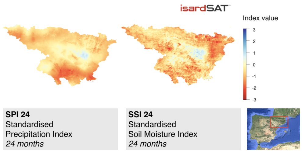
Above : Comparison between SSI-24 and gridded SPI-24 of the Ebro basin for November 2017
This article is adapted from Sentinel Online
As climate change drives drier and hotter conditions, scientists have used SMOS data to build a soil moisture index that could serve as a tool to monitor long-term droughts globally. Reported in Remote Sensing, the index was developed and validated using the Ebro Basin as a case study – a drought-prone region of the Iberian Peninsula.
During the study, the team drew on SMOS data to resolve a 1 km-resolution soil moisture product covering the entire Ebro Basin, from June 2010 until May 2023. This data was used to compute the SSI, which follows a similar formulation as the widely-used SPI, but provides new insights on droughts from remote sensing data – with global availability. Across the study period, the SSI was calculated over 6-, 12-and 24-month time periods to capture both short- and long-term droughts.
Capturing missing hydrological information
The team verified the performance of the soil moisture-based SSI using a precipitation-based SPI developed from rainfall readings collected at 239 meteorological stations across the Ebro Basin.
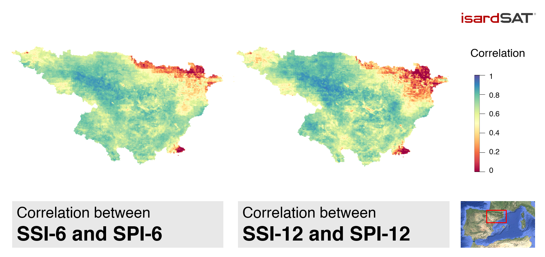
Spatial distribution of the correlation between the SSI and the gridded-SPI at 6 and 12 months of integration time over the studied area.
During the analysis, the team found that soil moisture-based SSI readings matched with rainfall-based SPI readings from one month earlier, due to the time it takes for rain to seep into the soil. When incorporating this time lag, they found that SSI displayed a strong correlation with the SPI over the 3-, 6-, 12-and 24-month time periods employed, demonstrating that the satellite-based index can reliably monitor drought conditions.
But the more significant finding was how the two indices diverged. In wet conditions, for example, the SSI increased more slowly in certain areas, likely due to hydrological factors that influence soil moisture – such as soil type, vegetation and runoff – that rainfall measurements simply don’t capture. Because these factors are closely linked to long-term water availability, the SSI may be better suited than the SPI for monitoring the later stages of prolonged drought.
In addition, the satellite-SSI has high spatial resolution thanks to the consistent global coverage of SMOS, making it very useful in remote areas with few ground-based meteorological stations.