François Cabot and Nicolas Reul, in the framework of CATDS joined forces to produce this first ever global map of sea surface salinity and Soil moisture all produced with the same instrument: SMOS!
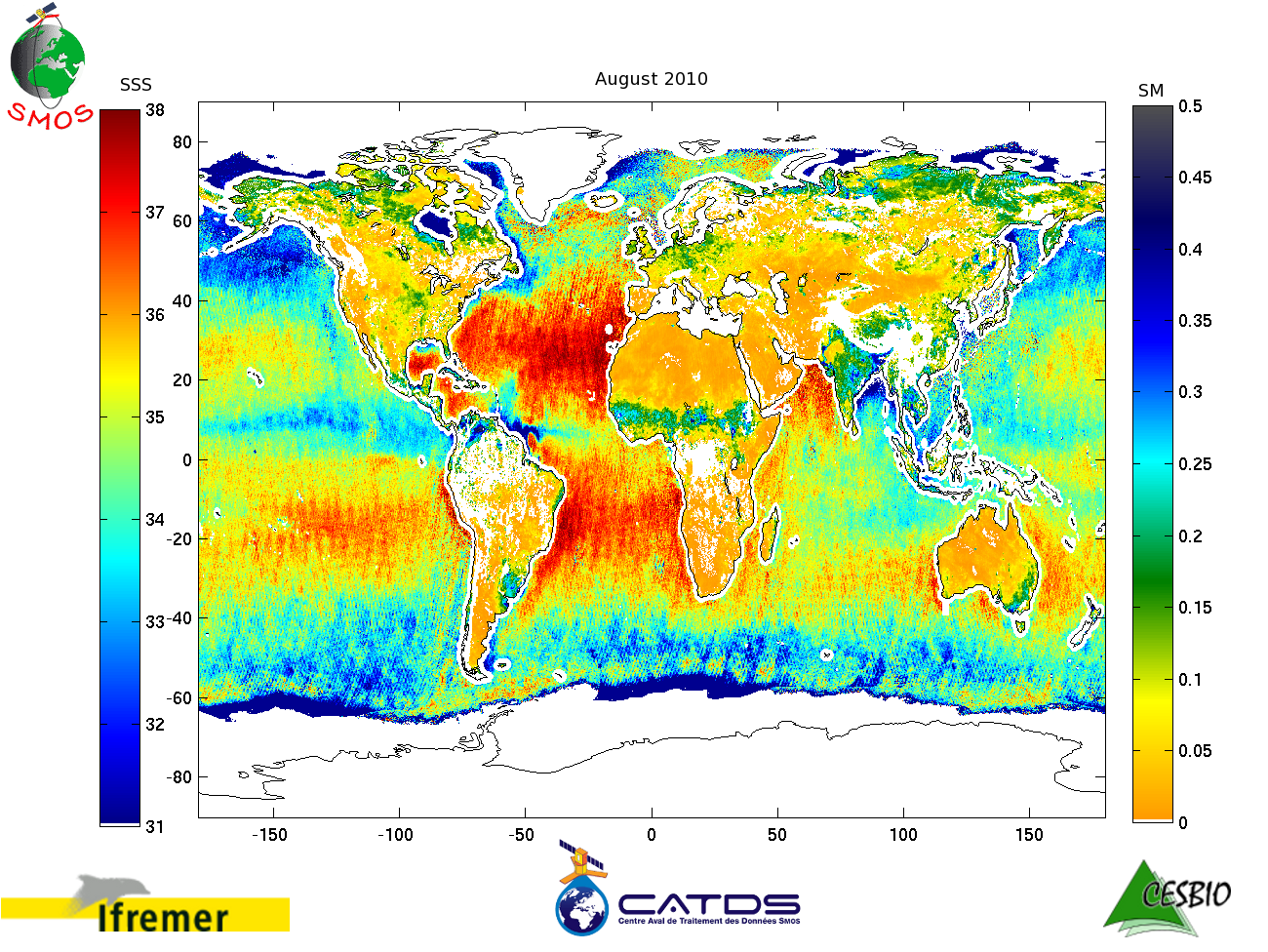
SMOS data used to obtain this level 3 were acquired over the month of August 2010.
Some imperfections are still visible but the Level 1 and level 2 teams are working hard on solving them!
Stay tuned!