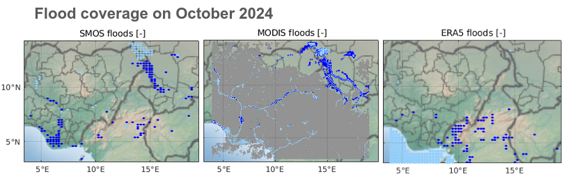
Above : flood detection on October 2024, near lake Chad and the Niger Delta. Detection is based on the upper tail of the soil moisture distribution (SMOS and ERA5), and based on IR-visible MODIS data. Grey = lack of data (due to cloud cover).
It is well accepted that numerical models are improving constantly and deliver valuable information about the Earth environment, to the point that reanalysis outputs are sometimes treated as ‘measurements’. Although this can be a good approximation in some cases, one shall be cautious with their use when it comes to specific metrics or areas.
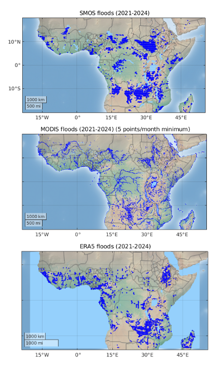
On this subject, a new letter by L. Hué has recently been published, taking the example of high soil moisture events, such as floods, in Tropical Africa. The focus on extreme events is chosen because it allows the use of two fully independent datasets : SMOS and MODIS. Moreover, this metric is often a weak point for models, which struggle to simulate scenarios that fall outside the “nominal case”. The study confirms that for flood monitoring, reanalysis significatly diverges from observations, while the two independent satellite datasets show good consistency, highlighting how crucial the choice of the dataset is for the relevance of the studies conducted.
More information are given on the published letter !
Below : flood detection for all Tropical Africa over the 2021-2024 timespan.