Queensland state in Australia has been heavily flooded since the end of December.
Since the end of December the Queensland state of Australia has been subject to a very large flooding event. Flood alerts are in place for at least 10 rivers, more than 20 cities and towns are waterlogged, 72 people are missing and at least eight dead. This could be the biggest flood since 1974 for Brisbane, the capital of Queensland.
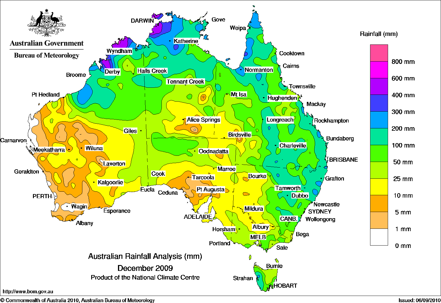
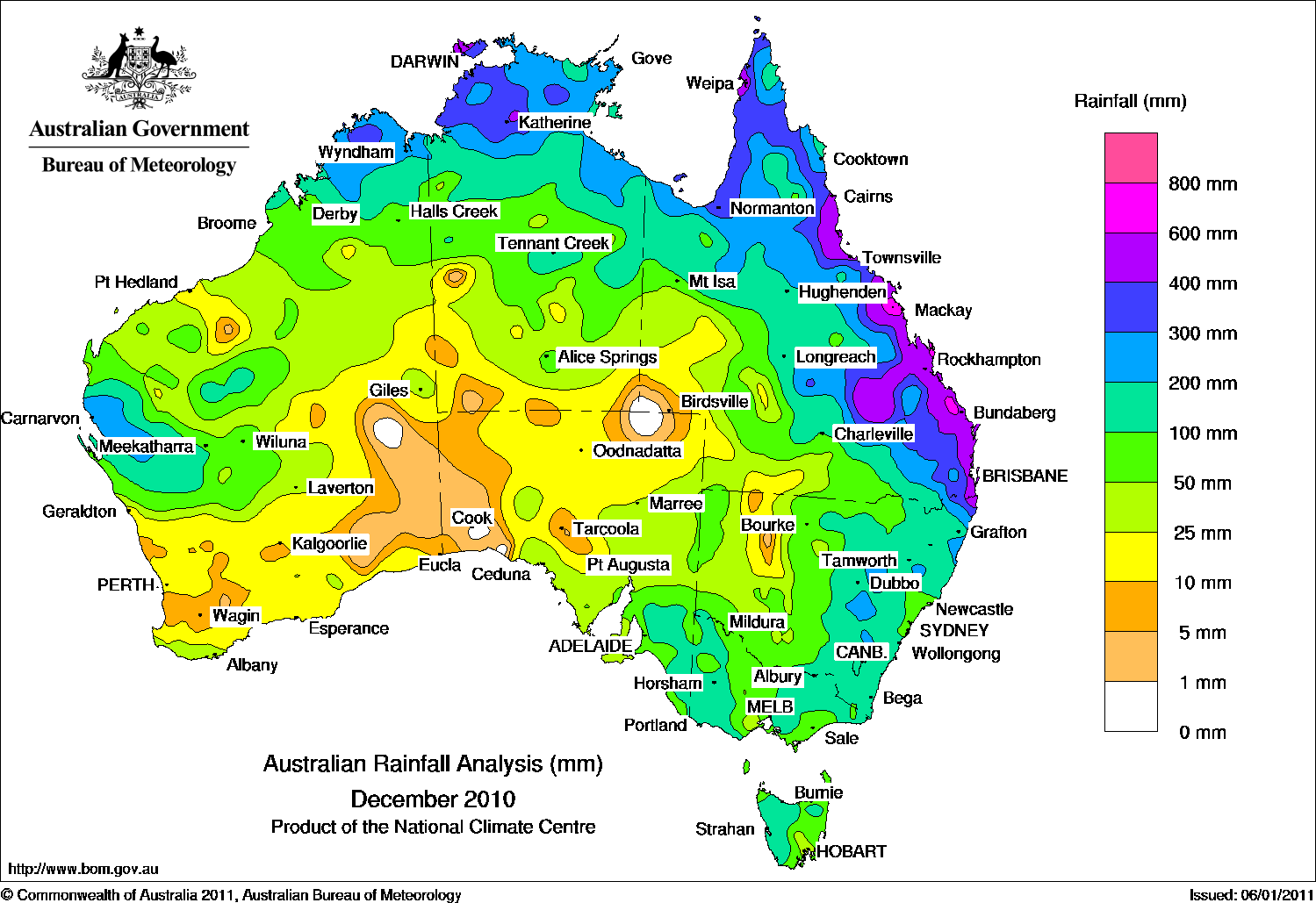
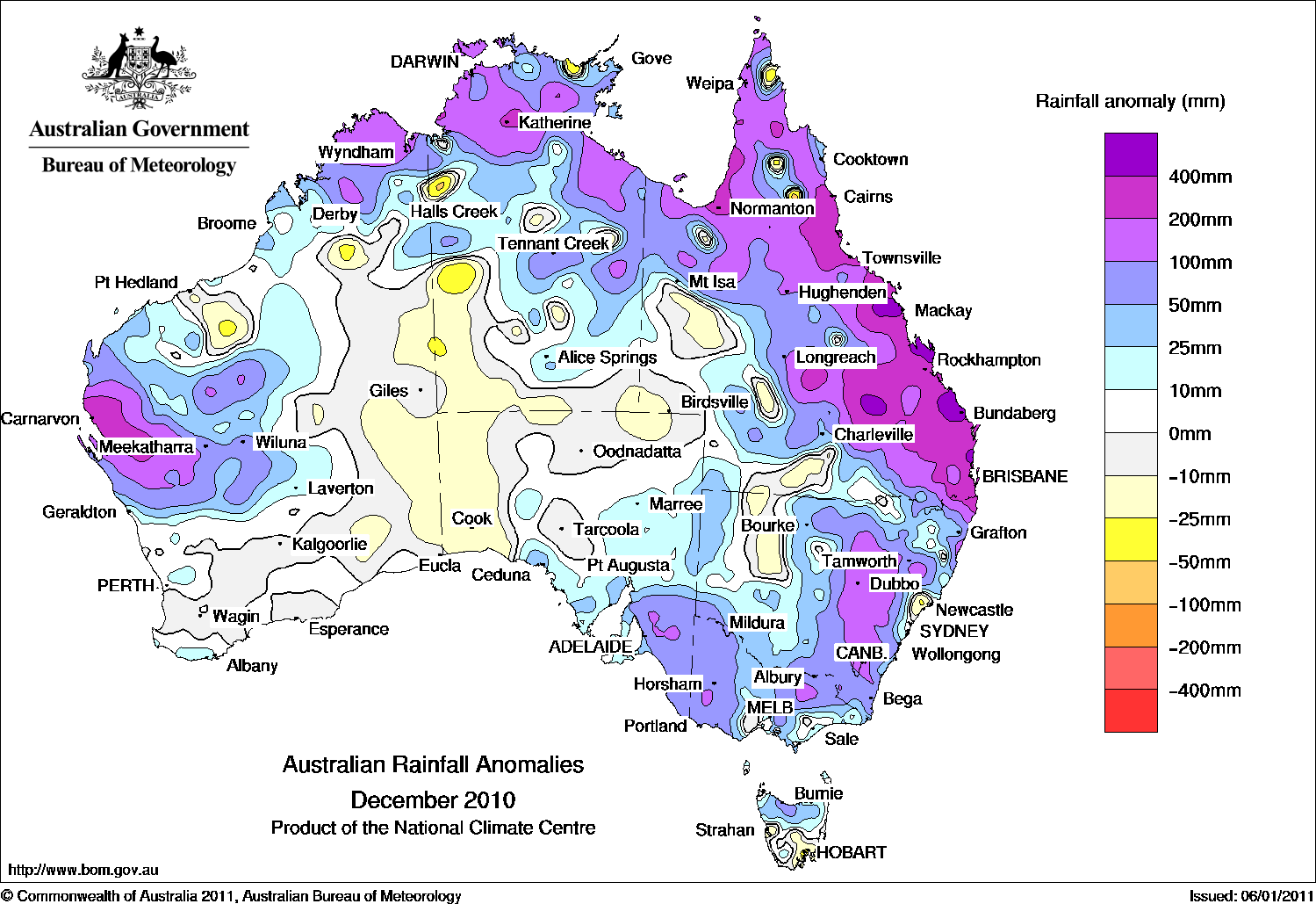
These flooding can be explained by a serie of heavy precipitation during the month of December on the North-East Australian coast. The following pictures show total rainfall recorded during the months of December 2009 and 2010. The cumulated rainfall is clearly higher in 2010 than average conditions as shown by the anomalies maps. More to the point, the first rains drenched/saturated the top soils so that the subsequent rain event laed to flooding. And this all the more as the rains remained very significant.
 |
 |
 |
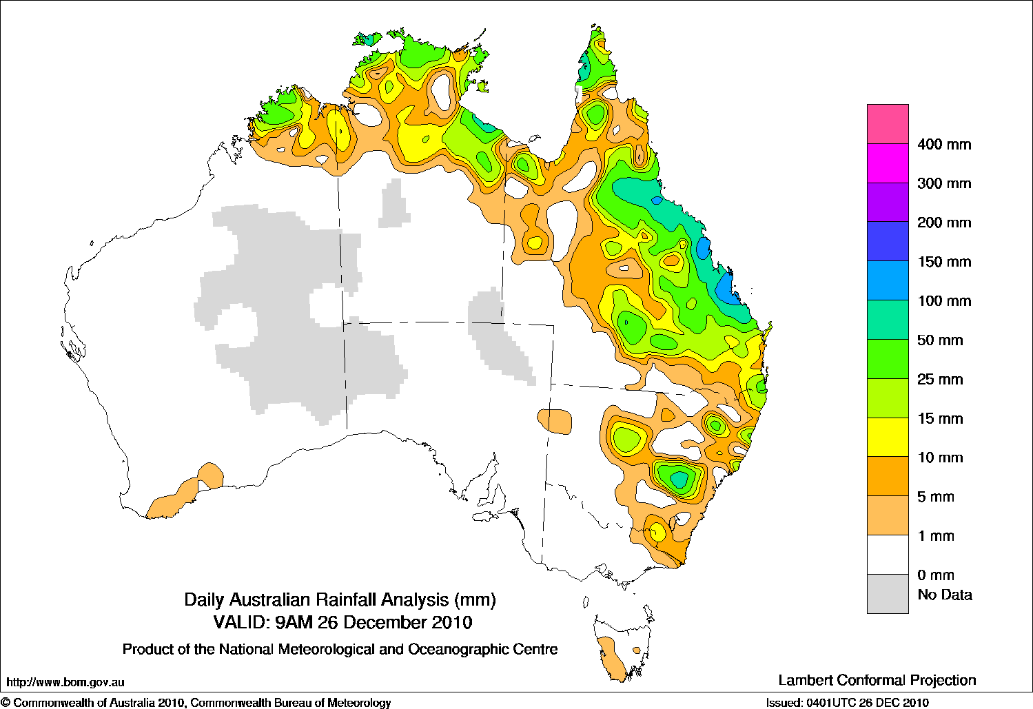
The major part of precipitation was during the week 22-28th of December as shown by the first following picture. Some places received more than 300 or 400 mm of rain during this short period. Soils were quickly saturated causing surface flow. The 25th December, the Tropical Cyclone Tasha exacerbated the widespread floods. SMOS soil moisture map shows saturated soil area after Tasha.
 |
 |
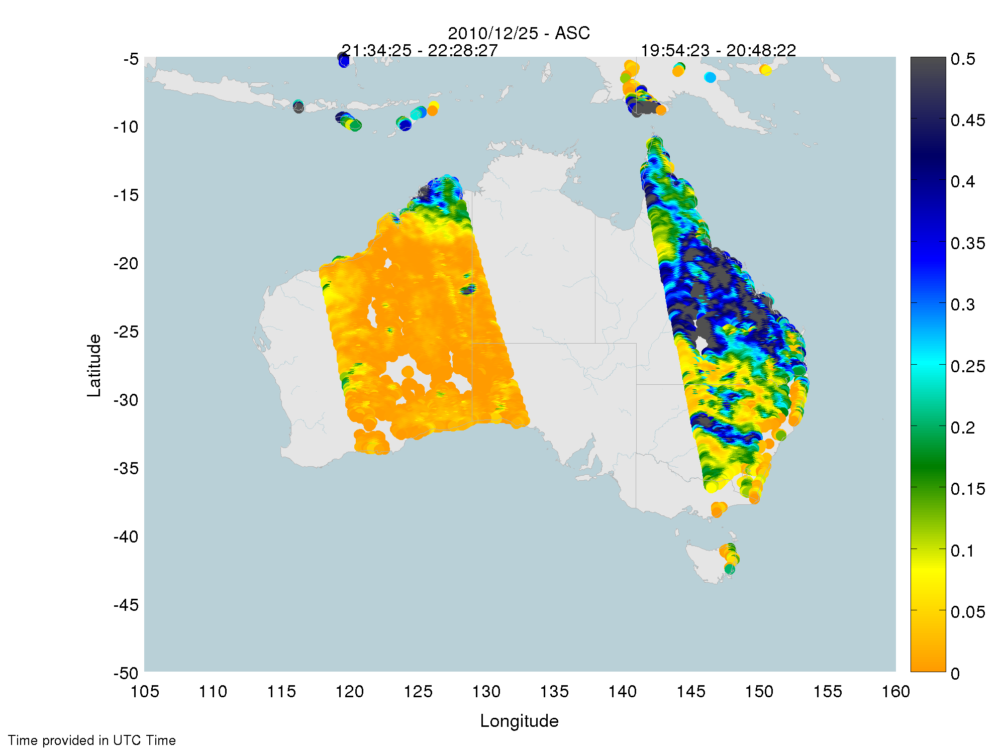 |
Queensland is still flooded as seen by SMOS (see SMOS soil moisture map). The International Charter was activated on the 3rd of January. However, currently, no map of the flooded areas has been provided, It is usually admitted that the area affected is roughly equivalent to France and Germany combined.

SMOS perfectly recorded high soil moisture values during December. Soil saturation can be estimated from the soil moisture products. Combined to precipitation information, this index could allow anticipating flood risks.
Arnaud Mialon and Claire Gruhier